Did you know ArcGIS Earth supports NMEA log file import, enabling you to visualize and analyze GPS tracks with ease?
📡 What is NMEA 0183?
NMEA 0183 is a widely adopted standard developed by the National Marine Electronics Association. It defines how GPS devices and marine instruments—such as sonar, anemometers, autopilots, and more—communicate using simple ASCII “sentences” over serial connections.
It’s the most common GPS data format, supported by virtually every GPS manufacturer.
🗺️ ArcGIS Earth Makes It Visual
Simply import a NMEA-formatted log file into ArcGIS Earth to bring your movements to life on a map.
🔁 Playback & Insight at Your Fingertips
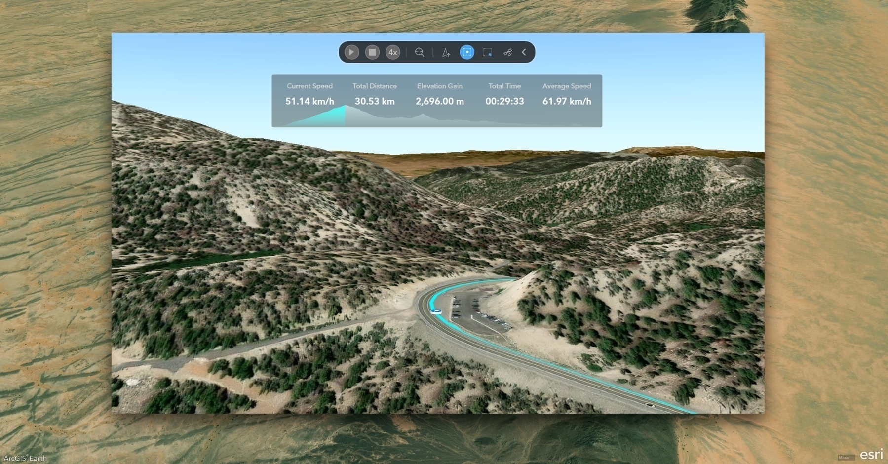
Once imported, select the NMEA layer to open the GNSS Toolbar and Dashboard:
- ▶️ Play or pause the GPS track
- 🐇🐢 Adjust playback speed in real time
- 🧭 Choose your view mode: Track-Up, Keep at Center, or Keep within Window
- 📊 View live stats: current speed, total distance, elevation gain, total time, and average speed
- 📈 Monitor progress with an interactive elevation profile
🎯 Real-World Application
Whether you’re reviewing a field mission, validating GPS data, or training with real-world tracks, this feature transforms raw GPS logs into powerful, interactive stories.