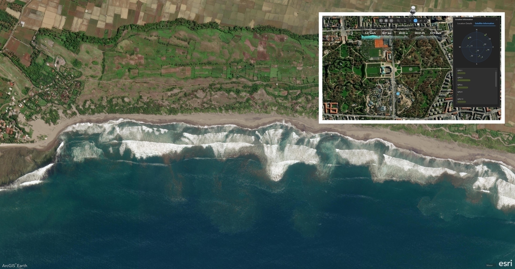
Did you know that ArcGIS Earth not only replays NMEA GPS tracks—but also lets you explore detailed positioning and satellite data at every moment?
📍 Go Beyond the Map with Location Information When working with an imported NMEA log, click the Location Information button to open two insightful tabs:
🧭 Location Details
Access key metrics about the device’s current position:
- Latitude, Longitude, Altitude
- Accuracy level and Fix type
- HDOP (Horizontal Dilution of Precision)
- VDOP (Vertical Dilution of Precision)
- PDOP (Positional Dilution of Precision)
These details help you assess GPS signal quality and positioning precision throughout the track.
🛰 Satellite Information
Visualize the satellite environment in real time:
- View the relative position of each satellite in the sky
- Signal strength is displayed with dynamic bars—longer and darker = stronger signal
- A compass-style map shows satellites orbiting around the device at the center
✨ This view updates continuously, giving you a real-time window into satellite coverage and positioning accuracy.