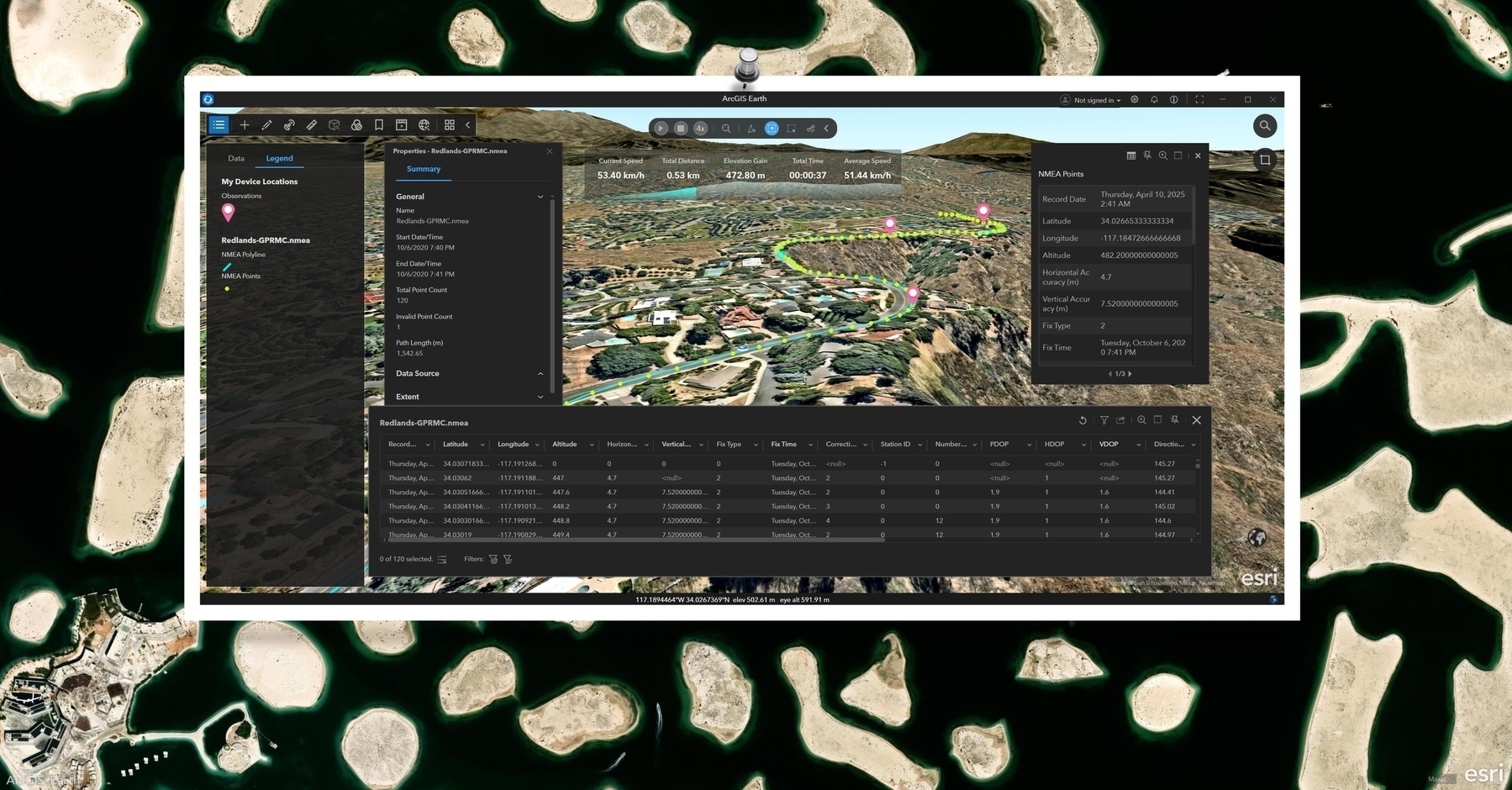
Think your GPS tracks are just lines? Think again! ArcGIS Earth empowers you to dive deep into the metadata, attributes, and statistics embedded within your imported NMEA layers, revealing the full story.
📄 Explore Layer Details:
Right-click the NMEA layer and select “Properties” to access:
- Metadata: spatial reference, extent, data source, and more.
- Summary Statistics: a quick snapshot of your dataset’s structure.
🖱️ Instant Feature Insights:
- Use the “Identify” tool to click any point or segment and instantly view its attribute information in a pop-up. Perfect for on-the-fly checks during playback or exploration.
📊 Dive into the Data Table:
Open the “Attribute Table” to:
- See all your GPS records in one comprehensive view.
- Sort, filter, and analyze your data effectively.
- Select specific records and zoom directly to them on the map.
✨ Go beyond the lines! ArcGIS Earth provides the tools to unlock the rich contextual information within your NMEA data, transforming simple tracks into powerful insights.