Want to share or archive your GPS tracks from ArcGIS Earth? Exporting your NMEA layer as a KML file is quick and easy.
📁 Simple Export:
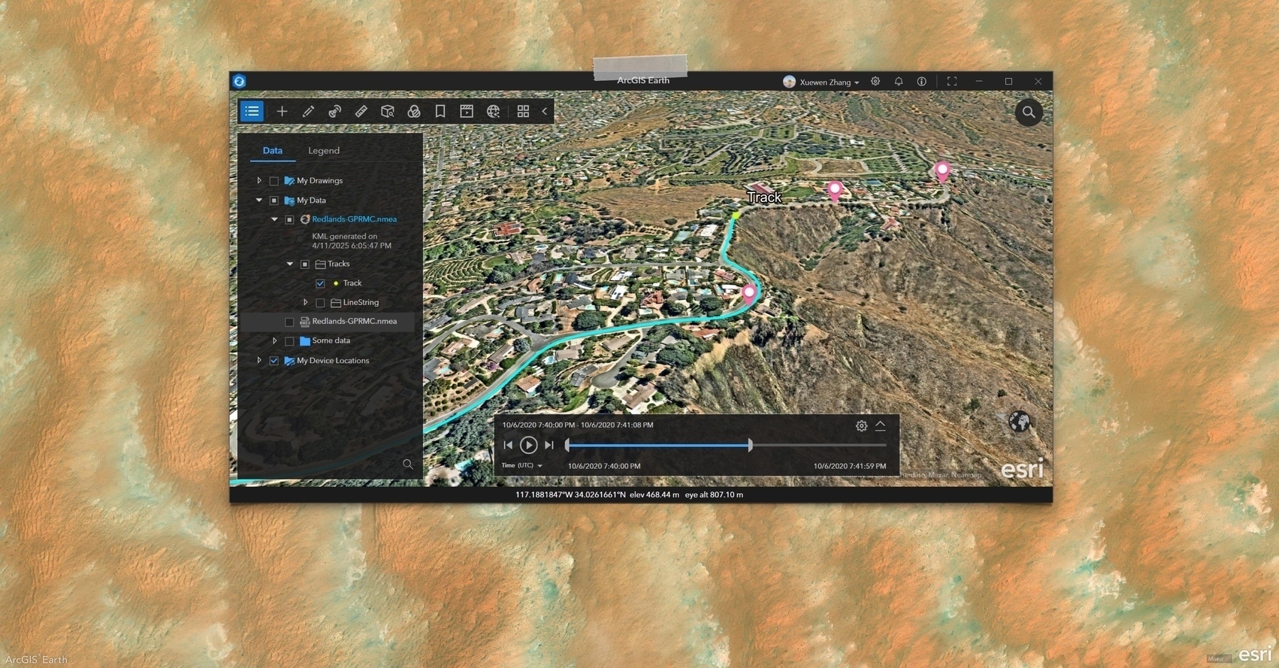
After importing and visualizing your NMEA log, right-click the layer and save. You’ll get:
- Points representing individual GPS fixes.
- Polylines connecting your track path.
It’s the perfect way to share your routes or archive valuable tracking data.
🚀 Coming Soon: Enhanced KML Tracks:
Currently, ArcGIS Earth exports points and lines to KML. Stay tuned for full KML Track support, including timestamped playback and richer temporal visualization!
✨ ArcGIS Earth empowers you to not only review your GPS logs but also transform them into easily shareable and presentation-ready KML files.