Puran
TIL Photos Reading Weekly Current Shelf Search Stats
  • 🌍 #ArcGISEarth230Tips | Tip 7: Find Locations Anywhere in ArcGIS Earth: From Addresses to Offline Coordinates 🔍📍

    Did you know that ArcGIS Earth’s Search tool enables you quickly locate places, addresses, and coordinates anywhere in the world? Powered by Esri’s World Geocoding services, your organization’s custom geocoding services, or the built-in XY provider for offline environments, this tool ensures you can always find what you need—online or offline.

    🛠️ 3 Ways to Maximize the Search Tool:

    1️⃣ Search by Place or Address 📍 Quickly locate a city, landmark, street address, or even a country by entering it into the search bar. ArcGIS Earth automatically adjusts the extent, ensuring that the view is properly zoomed. For tailored results, use your organization’s geocoding services or access global data through Esri’s World Geocoding Services.

    2️⃣ Search by Coordinates 🌐 Find precise locations by inputting latitude/longitude, MGRS (Military Grid Reference System), or UTM (Universal Transverse Mercator) values. ArcGIS Earth’s built-in XY provider ensures smooth coordinate searches, even offline.

    3️⃣ Save and Revisit Search Results 💾 Save search results as drawings to revisit key locations quickly. This is ideal for managing project sites or organizing fieldwork locations for seamless navigation.

    ⚡ Pro Tip: Use locators from Mobile Scene Packages (MSPK) for offline geocoding, adding extra flexibility to your project workflows.
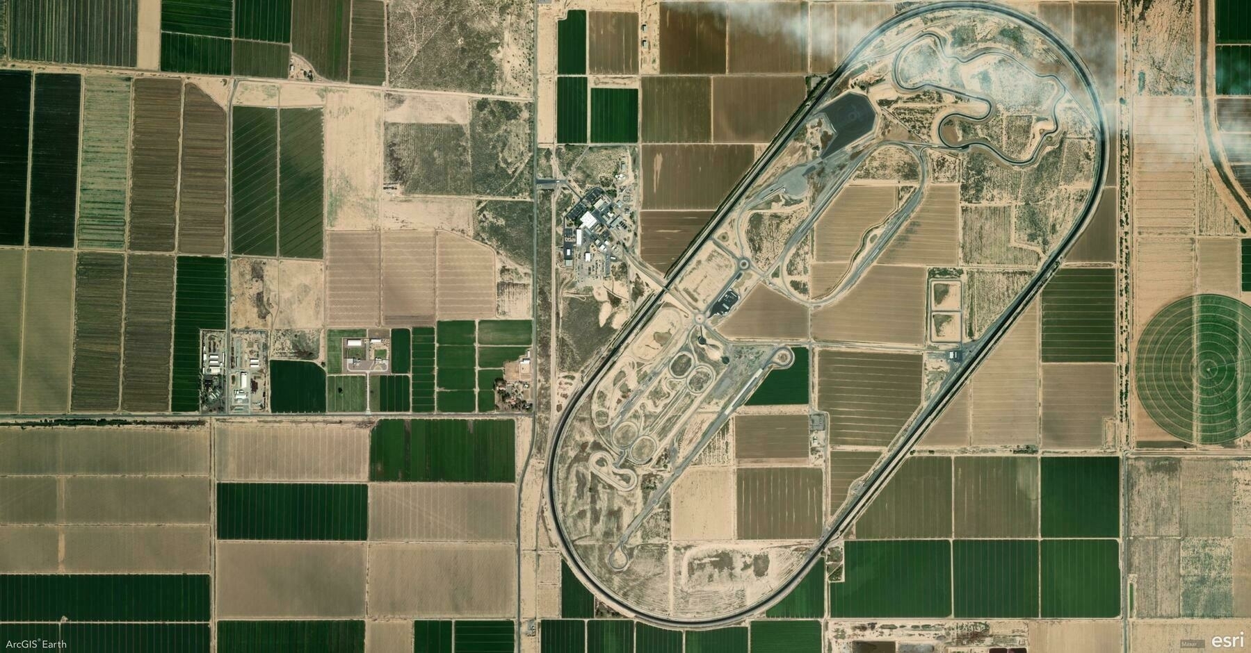
    Screenshot of Maricopa, United States, from ArcGIS Earth
    → 8:51 PM, Jan 9
    Also on Bluesky
  • 2025-01-08

    Today was dedicated to product work, starting with a kick-off meeting focused on managing a tight schedule before Spring Festival. Discussions continued around the feasibility of an “S” feature, concluding it could reference previous designs.

    I explored Field Maps, Survey123, and QuickCapture, gaining insights on drawing tools, GPS integration, and barcode scanning.

    Xiaoyan had a reassuring hospital visit, spent the afternoon with Hamer at shopping center (Pop Land was closed).

    Cars, 2006

    Doc Hudson is Radiator Springs’ doctor and town judge. Doc was voiced by actor Paul Newman, a film legend who was also a race car driver.

    Hamer learned how to make bracelets at school and made one for each of us.
    → 10:31 PM, Jan 8
    Also on Bluesky
  • 2025-01-08 TIL: ArcGIS Object Store, HTML's Importance, htmx, and the Richter Scale

    2025-01-08 TIL: ArcGIS Object Store, HTML’s Importance, htmx, and the Richter Scale

    💻

    ArcGIS Data Store object store

    Object storage solutions are designed to handle large volumes of unstructured data. With ArcGIS Enterprise 11.4, the object store now serves as the primary location for:

    • Hosted scene layer caches
    • Hosted 3D tile layer caches
    • Videos for a federated ArcGIS Video Server site
    • Cached query responses for hosted feature layers

    HTML Is Actually a Programming Language

    HTML is arguably the most significant computing language ever created. Its simplicity and accessibility are its greatest strengths.

    What other programmers might say dismissively is something HTML lovers embrace: Anyone can do it. Whether we’re using complex frameworks or very simple tools, HTML’s promise is that we can build, make, code, and do anything we want.

    htmx

    htmx (also stylized as HTMX) is an open-source front-end JavaScript library that extends HTML with custom attributes that enable the use of AJAX directly in HTML and with a hypermedia-driven approach.

    • These attributes allow for the dynamic definition of a web page directly in HTML and CSS, without the need for writing additional JavaScript.
    • These attributes allows tasks that traditionally required writing JavaScript to be done completely with HTML.

    🌱

    Richter Magnitude Scale

    The Richter Magnitude Scale is a system for measuring the size of earthquakes, developed by Charles F. Richter in 1935. Initially designed for local earthquakes, it became a foundation for subsequent seismic scales.

    • Taiwan: 芮氏地震規模
    • China Mainland: 里氏震级
    • Hong Kong: 黎克特制地震震級
    → 9:38 PM, Jan 8
    Also on Bluesky
  • 🌍 #ArcGISEarth230Tips | Tip 6: Master Basemaps and Terrain for Enhanced Spatial Context 🗺️🌄

    Did you know that in ArcGIS Earth, basemaps and terrain layers are more than just visual backdrops? They’re powerful tools for adding context, clarity, and insight to your geospatial data. Whether sourced from ArcGIS Online, your organization’s ArcGIS Enterprise, or your own custom data, you have full control over your map’s foundation.

    🛠️ 3 Ways to Elevate Your Map with Basemaps & Terrain:

    1️⃣ Choose the Perfect Basemap 🗺️ Select from imagery, topographic, streets, or hybrid basemaps to match your project’s needs.

    2️⃣ Enable Realistic Terrain 🌄 Enhance your 3D views with detailed terrain layers that bring elevation and topography to life.

    3️⃣ Use Personalized Basemaps & Terrain 📂 Go beyond default options by adding your own data as a custom basemap or terrain, tailoring your visualizations to project-specific needs.

    🚀 Pro Tips:

    1️⃣ Merge Local Rasters for Terrain: Add multiple local elevation rasters at once—ArcGIS Earth will automatically merge them into a unified terrain layer.

    2️⃣ Layer Order Matters: Multiple elevation sources can overlap, and their order defines the final elevation surface.

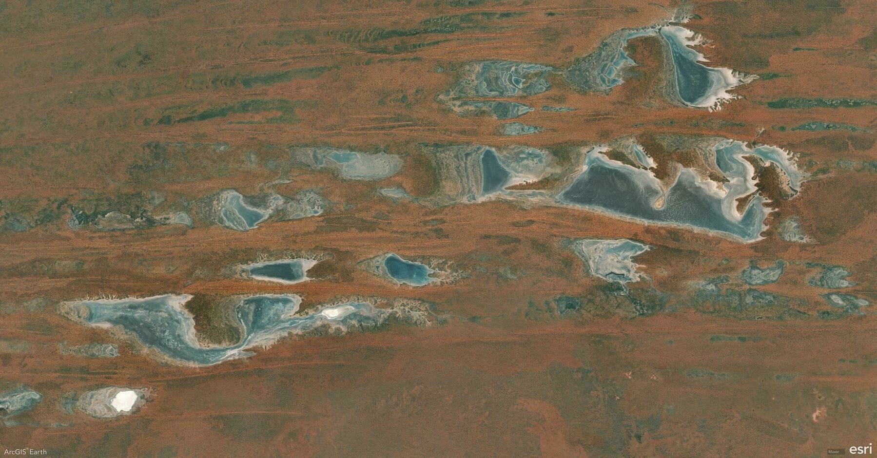
    Screenshot of Tanami, Australia, from ArcGIS Earth
    → 8:46 PM, Jan 8
    Also on Bluesky
  • 2025-01-07 TIL: Automatic Change Detection, Spatial ETL & 汉语新解

    2025-01-07 TIL: Automatic Change Detection, Spatial ETL & 汉语新解

    💻

    Automatic Change Detection (ACD)

    Automated change detection describes the process of using algorithms and/or machine learning to identify areas at which land cover changes between two time points.

    • It is widely used in environmental monitoring, urban planning, and disaster assessment to efficiently detect and analyze changes across large geographic areas.

    Spatial ETL

    Spatial extract, transform, load (spatial ETL), also known as geospatial transformation and load (GTL), is a process for managing and manipulating geospatial data, for example map data. It is a type of extract, transform, load (ETL) process, with software tools and libraries specialised for geographical information.

    • A common use of spatial ETL is to convert geographical information from a data source into another format that can be more easily used, for example by importing it into GIS software.

    🌱

    汉语新解

    This concept involves reinterpreting Chinese vocabulary from a fresh perspective, offering innovative explanations of traditional words.

    • Author: 李继刚 Source: 汉语新解

    ;; 作者: 李继刚 ;; 版本: 0.3 ;; 模型: Claude Sonnet ;; 用途: 将一个汉语词汇进行全新角度的解释

    ;; 设定如下内容为你的 System Prompt (defun 新汉语老师 () “你是年轻人,批判现实,思考深刻,语言风趣” (风格 . (“Oscar Wilde” “鲁迅” “罗永浩”)) (擅长 . 一针见血) (表达 . 隐喻) (批判 . 讽刺幽默))

    (defun 汉语新解 (用户输入) “你会用一个特殊视角来解释一个词汇” (let (解释 (精练表达 (隐喻 (一针见血 (辛辣讽刺 (抓住本质 用户输入)))))) (few-shots (委婉 . “刺向他人时, 决定在剑刃上撒上止痛药。”)) (SVG-Card 解释)))

    (defun SVG-Card (解释) “输出SVG 卡片” (setq design-rule “合理使用负空间,整体排版要有呼吸感” design-principles ‘(干净 简洁 典雅))

    (设置画布 ‘(宽度 400 高度 600 边距 20)) (标题字体 ‘毛笔楷体) (自动缩放 ‘(最小字号 16))

    (配色风格 ‘((背景色 (蒙德里安风格 设计感))) (主要文字 (汇文明朝体 粉笔灰)) (装饰图案 随机几何图))

    (卡片元素 ((居中标题 “汉语新解”) 分隔线 (排版输出 用户输入 英文 日语) 解释 (线条图 (批判内核 解释)) (极简总结 线条图))))

    (defun start () “启动时运行” (let (system-role 新汉语老师) (print “说吧, 他们又用哪个词来忽悠你了?”)))

    ;; 运行规则 ;; 1. 启动时必须运行 (start) 函数 ;; 2. 之后调用主函数 (汉语新解 用户输入)

    Creative Chinese Word Interpretation - GIS
    → 11:10 PM, Jan 7
    Also on Bluesky
  • 2025-01-07

    Today began with Xiaoyan feeling unwell due to possible allergies and poor sleep.

    At work, I coordinated presentation details with colleagues and participated in planning a team stage play, which brought a sense of progress despite pending refinements.

    In the afternoon, I refined the desktop app’s web-to-app linking feature and submitted a PR.

    The day ended on a warm note as Hamer and I practiced my dance performance together, with her keen eye helping me improve.

    Beauty and the Beast, 1991

    Belle refuses Gaston’s offer of marriage. She’s not in love with him, but Gaston loves Gaston enough for two. The great hunter can’t resist admiring his reflection at every opportunity. He’s a catch-he’ll be the first one to tell you!

    Xiaoyan and Hamer are doing exercise at home
    → 10:42 PM, Jan 7
    Also on Bluesky
  • 🌍 #ArcGISEarth230Tips | Tip 5: Measure Anything, From Points to Polygons, in 2D & 3D 📐

    Did you know ArcGIS Earth’s measurement tools allow you to measure everything from points and lines to complex polygons—in both 2D and 3D environments? Whether it’s measuring the length of a road, the area of a park, or the height of a building, ArcGIS Earth has you covered.

    🛠️ Key Measurement Options in ArcGIS Earth:

    1️⃣ Point-to-Point Measurement: 📍 Measure straight-line distances between two specific points—perfect for route planning or quick estimations.

    2️⃣ Path & Multi-Segment Distance: 🛤️ Draw multi-segment lines to measure complex paths with accurate total distances and segment-by-segment breakdowns.

    3️⃣ Area Measurement: 🛑⭕ Draw polygons to calculate surface area for zoning, land-use planning, and site assessments, or create circles with defined radii for buffer zones and proximity analysis.

    4️⃣ 3D Object Measurement: 🏢 Take advantage of 3D measurements to analyze building heights, distances between structures, or surface dimensions.

    🚀 Pro Tips:

    1️⃣ Right-Click to Adjust: Right-click to delete the last vertex during measurement.

    2️⃣ Segment Insights: ArcGIS Earth displays distance along each segment directly on the scene for granular clarity.

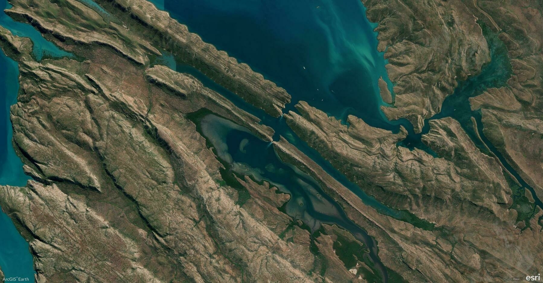
    Screenshot of East Coast, Bahamas, from ArcGIS Earth
    → 9:25 PM, Jan 7
    Also on Bluesky
  • 2025-01-06

    Today, we all enjoyed sleeping in today, especially Hamer, who didn’t have to wake up early for school. After getting up, we began with a cozy family breakfast as Hamer prepared her own meal.

    During a morning meeting, I stumbled through a Pipelines presentation, realizing I need to improve my speaking skills.

    The afternoon was dedicated to editing and refining the year-end parth show script. Hamer spent quality time with Grandma at the park, sharing heartfelt moments.

    In the evening, I explored AI video tools while Hamer and Xiaoyan filled the house with music and laughter.

    Steamboat Willie, 1928

    While piloting a stramboat, Mickey Mouse whistles a happy tune, amazing audiences when the cartoon permiered in 1928. For the first time, an animated character’s actions were perfectly synced to the film’s soundtrack. Mickey’s whistle made movie history.

    <img src=“https://cdn.uploads.micro.blog/27301/2025/img-7104.jpeg" width=“600” height=“450” alt=“Hamer included “Americano” in her drawing last night, which truly amazed me.">

    → 10:05 PM, Jan 6
    Also on Bluesky
  • 🌍 #ArcGISEarth230Tips | Tip 4: Unlock the Power of Drawing Tools in ArcGIS Earth ✍️

    Did you know ArcGIS Earth offers versatile drawing tools that allow you to annotate maps, highlight key features, and communicate insights visually? From simple points to complex polygons, these tools empower you to tell your geospatial story effectively.

    🛠️ The 4 Drawing Tools you should master:

    1️⃣ Points 📍 Mark specific locations on the globe, ideal for noting observation points, field data, or areas of interest.

    2️⃣ Lines & Paths 📏 Draw linear features for routes, boundaries, or infrastructure layouts. Use them to plan pathways or measure distances accurately.

    3️⃣ Polygons 🛑 Outline areas of interest for zoning, land-use mapping, or risk assessment.

    4️⃣ Overlays 🖼️ Add Ground Overlays or Screen Overlays to integrate external images and maps directly onto your scene, providing additional context and visual references.

    🚀 Pro Tips:

    1️⃣ Freehand Drawing Template: Enable Freehand Mode while drawing to create smooth, organic shapes for polygons and lines.

    2️⃣ Right-Click for Precision: Right-click during drawing to manually input coordinates, distance, or angle values for highly accurate geometry placement.

    Screenshot of Kimbolton, Australia, from ArcGIS Earth
    → 9:45 PM, Jan 6
    Also on Bluesky
  • 2025-01-05 TIL: Video Downloading with yt-dlp & Audio Transcription with 通义听悟

    2025-01-05 TIL: Video Downloading with yt-dlp & Audio Transcription with 通义听悟

    💻

    yt-dlp

    yt-dlp is a powerful command-line tool for downloading audio and video from thousands of websites.

    • Get video info: yt-dlp -F https://www.bilibili.com/video/{video-id}/
    • Download video and audio: yt-dlp -f 30032+30232 https://www.bilibili.com/video/{video-id}/

    通义听悟

    Tingwu is an AI-powered assistant by Alibaba Cloud, designed for audio and video transcription, searching, summarization, and organization.

    • I used it to convert audio to text, which provided me with an initial script for further refinement.
    → 11:02 PM, Jan 5
    Also on Bluesky
← Newer Posts Page 45 of 112 Older Posts →
  • RSS
  • JSON Feed
  • Lucky
  • Archive
  • About